The Best Cross County Skiing & Snowshoeing
Nordic Trails, Sno-Parks, Maps
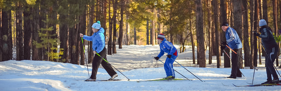
Cross country skiing and snowshoeing are popular around Sonora Pass because of the availability of so many excellent cross country skiing and snowshoe routes up and down the pass.
Winter Safety
Changing winter conditions can make virtually any cross country or snowshoe route unsafe. Always check with the Forest Service or the local Ski Patrol for information about snow conditions. Avalanches can occur even on gentle slopes and even among trees. Icy trails can be treacherous. Soft, deep snow can strand back country travelers.
- Always carry a fully charged cell phone and other emergency gear, including a satellite communications device such as the: Garmin inReach Mini 2
- Let a responsible person know where you are going and when you will be returning.
- Travel with at least one other person.
Check the Stanislaus National Forest's information for complete advice about back country travel in the winter: Nordic Trail Map and Safety Information.
The Eastern Sierra Avalanche Center provides information about avalanche conditions in the eastern Sierra, including Sonora Pass. Visit their website at Eastern Sierra Avalanche Center.
The Sierra Avalanche Center for the Tahoe National Forest, although a little north of Sonora Pass, can provide valuable information about back country snow conditions. You can visit their website at Sierra Avalanche Center.
Shop Amazon:
Winter Apparel
Winter Apparel
Pinecrest - Dodge Ridge Area Ski Trails
The Summit Ranger District of the Stanislaus National Forest has 25.5 miles of cross country ski trails marked in the area southwest of Pinecrest, mostly in the vicinity of Dodge Ridge. The cross country ski trails vary in difficulty from easy, level trails to steep, narrow advanced routes. A map available at the Summit Ranger Station at the Pinecrest Y shows all the trails, indicates their length and level of difficulty, and provides an estimated time required to complete the route.
Cross Country Ski Trails Map for the Summit Ranger District of the Stanislaus National Forest.
The Pinecrest Cross Country Ski and Snowshoe Network is a group of local volunteers who are developing a free network of ski and snowshoe trails and paths leading away from plowed roads around Pinecrest. More information and a draft map of the Network's trails can be found at
Pinecrest Cross Country Ski and Snowshoe Network.
Cross country ski trailheads in the Dodge Ridge area are located at Gooseberry and at Crabtree on Forest Road 4N35 near Dodge Ridge. A pit toilet is located at the Crabtree trailhead.
Cross Country Ski Trails Map for the Summit Ranger District of the Stanislaus National Forest.
Volunteer members of the Pinecrest Nordic Patrol are usually on the trails on weekends and holidays to assist cross country skiers. They are members of the National Ski Patrol. A yellow sign at the beginning of a trail indicates when a Pinecrest Nordic Patrol volunteer is present.
Stanislaus National Forest Snowshoe Hikes
In the past, the Stanislaus National Forest hosted free, interpretive snowshoe hikes every Saturday during winter, weather permitting. Once the COVID pandemic has subsided, these hikes may be offered again. Look for notices of the hikes in 2024-2025.
TOP
Other Tuolumne County Cross-country Ski and Snowshoe Trails
Highway 108 at the Sno-Park
Although snowmobilers like to launch their machines from the Sno-Park at the end of the plowed road 6 miles past Strawberry, cross country skiers find plenty of trails on their own. From the Sno-Park lot a logging road leads back almost parallel to the highway for about half a mile.
For a little more distance head east out Highway 108 for 1½ miles to the Cascade Creek area. There you can find a number of forest roads leading away from either side of the highway.
Sno-Parks are parking areas maintained in the winter to allow people to park safely and pursue winter activities such as cross-county skiing or snowmobiling. They have pit toilets available. To use a Sno-Parks you must have a permit. You can purchase a day permit for $15 or an annual pass (Nov. 1 - May 30) for $40. They are good at any California Sno-Park and any Sno-Park in Oregon, Washington, and Idaho. Sno-Park passes from those states are good in California. Limited overnight parking is available.
Sno-Park passes can be purchased online for an extra $1.95 at
Sno-Park Permits.
There is only one Sno-Park in Tuolumne County on Highway 108. Two Sno-Park parking lots (north and south) are set up near the end of the plowed portion of Highway 108 about 6 miles east of Strawberry. Popular activities there are snowmobiling, cross-country skiing, and "limited snow play."
Strawberry - Sugar Pine Railroad Trail
A popular hiking and mountain bike trail runs from Old Strawberry Road downstream parallel to the Stanislaus River to Fraser Flat. In the winter this makes a good cross country ski trail. If the road down to Fraser Flat is open, then that makes a good starting point since your return trip will have a slight downhill grade. For more about this route see Sugar Pine Railroad Trail in our Mountain Biking section.
Twain Harte
Like the Sugar Pine Railroad Trail, the railroad grade from Twain Harte to Lyons Reservoir can make a good cross country ski route if the snow conditions are right. For more about this route see Twain Harte to Lyons Reservoir - Railroad Grade in our Mountain Biking section.
Mono County Nordic Skiing and Snowshoe Trails
Snow levels determine where Highway 108 is closed in the winter on the east side of the Sierra. Even if the road is closed only a mile west of Highway 395, wide open country is available for cross country skiing and snowshoeing.
Less than a mile from Highway 395 a road leads south from Highway 108. In 1.3 miles it passes Junction Reservoir and after 2.8 miles reaches Kirman Reservoir. A little more than a mile farther takes you to Mud Lake. The entire 4-mile-long trail only climbs and then descends about 400 feet in elevation.
If Highway 108 is open to Pickel Meadow, then all of the meadow and the back country beyond are open to the cross country skier or snowshoer.
Cross country skiing or snowshoeing in the Bridgeport Winter Recreation Area requires a permit. In general the area is the Leavitt Creek and Leavitt Lake watershed and areas west of there to the summit of the Sierra. For a map of the area, see Bridgeport Winter Recreation Area Map. For information about permits, see Bridgeport Winter Recreation Area.
Snowshoe Routes: Northern California (shown here) includes descriptions of snowshoe trails to Pickel Meadow, Poore Lake, Leavitt Meadow, and Secret Lake.