Footprints of the Early Pioneers
The Walker River Emigrant Trail
Among the most interesting of Sonora Pass Historic Sites are the emigrant trails. The Walker River Emigrant Trail was opened in 1852 and used by emigrant wagon trains until 1854. It diverged from the main California Trail at Fort Churchill on the Carson River in Nevada and swept south to the Walker River, following it to its headwaters at the summit of the Sierra Nevada.
The trail passed through today's Emigrant Wilderness, crossing the crest of Sierra 8 miles south of today's Sonora Pass. Emigrants eventually arrived at Dodge Ridge and then following roughly the route of Highway 108 to Sonora. Few remnants of the trail remain, but there are places you can view its route.
Pickel and Leavitt Meadows
Pickel Meadow
The Walker River Emigrant Trail descended the slope behind the Marine Mountain Warfare Training Center at Pickel Meadow, forded the Walker River and headed up Pickel Meadow to Poore Lake. From there it crossed the ridge to the upper end of Leavitt Meadow before turning southwest into the high mountains.
Burst Rock
You can drive out the long, gravel road to Gianelli's Cabin and then hike a mile to the summit of Burst Rock. The emigrant wagons came up the back side of Burst Rock and down the ridges toward Dodge Ridge. Several babies were born to the emigrants near Burst Rock, prompting some to call it Birth Rock. One emigrant child arrived in the middle of a snow storm.
Strawberry Flat Ranch at Pinecrest
In 1853 when emigrants reached the area around today's Camp Blue (near Pinecrest) they found a small farm house called the Strawberry Flat Ranch established by Samuel Wood. There the destitute pioneers could purchase fresh vegetables and hay for their stock. The emigrant trail angled up from Camp Blue to the ridge north of Highway 108 and followed the ridge top down through today's Pinecrest School, past Long Barn. At Sugarpine it cut off along the route of today's Middle Camp Road down through Twain Harte.
Read a full history of emigrants who crossed Sonora Pass in Sonora Pass Pioneers, offered for sale by the Tuolumne County Historical Society.
Gold Rush Era Miners' Ditches and Reservoirs
During the Gold Rush miners desperately needed water in Sonora and Columbia. The Tuolumne County Water Company built a ditch up to the site of today's Lyons Reservoir where they constructed a dam to divert water into the ditch. Other ditches were run to the North Fork of the Tuolumne River near Long Barn.
The Columbia and Stanislaus River Water Company constructed an ambitious ditch that ran from above today's Donnell Reservoir, down the Middle Fork of the Stanislaus, through a tunnel near Spring Gap, and then down the South Fork of the Stanislaus.
Strawberry Lake (Pinecrest Lake) and several reservoirs upstream from Strawberry Lake were built to enhance the summer water supply through the ditches.
Ditches Still in Use
Many miles of the early ditches and flumes are still in use today. They can be seen flowing serenely through neighborhoods in Twain Harte and Confidence. The best place to see a flume is at Lyons Dam. Take the Lyons Dam Road off Highway 108 (just east of Sierra Village) to the parking area by the reservoir and walk down the road to the dam. A trail with railings leads down to the foot of the dam where you can see the flume winding away along the side of the canyon, much the way it appeared in the 1850s.
Remnants of Old Gold Mining Era Reservoirs
If you hike upstream from the eastern end of Pinecrest Lake you will soon come to the remnants of a crib dam that held back the waters of Big Dam Reservoir. Middle Dam was located, naturally, between the other two reservoirs. There is no established trail to follow, however.
Relief Reservoir Dam
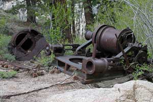
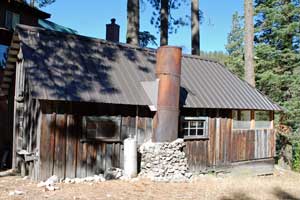
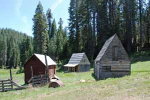
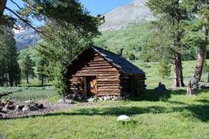
Relief Reservoir was built during the early 20th century. A road was carved out of the mountainside leading from Kennedy Meadows up the canyon to the site of the dam. Equipment was dragged up this steep route using steam donkeys and winches. Today remnants of the machinery used in the construction of the dam can be found scattered along the trailside. Near the dam the old blasting powder storage vault remains built into the side of the mountain.
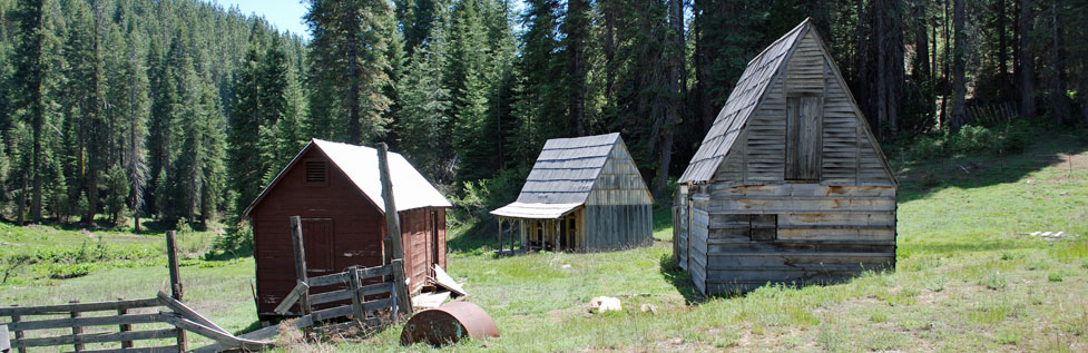
During the construction of the dam a small community of cabins for the workers was erected on the south slope of the mountain. Nothing remains of the settlement today. Proposals were made to build another dam in Kennedy Canyon and flood the entire valley, including Kennedy Lake; but the project never left the drawing table.
TOP
The Sonora and Mono Wagon Road
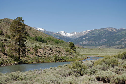
The Sonora and Mono Wagon Road was constructed in 1863-1864 to connect Tuolumne County with the mining districts on the eastern side of the Sierra, particularly Esmeralda, Nevada, and scattered strikes in Mono County. Remnants of the old wagon road abound along Highway 108, although they are sometimes difficult to recognize. The best sections to view are at the higher elevations on the western slope of Sonora Pass.
Cow Creek to Niagara Creek
Cow Creek Road follows the route of the early wagon road. At one time a ranger station stood on the bank of Cow creek. At Niagara Creek the old road followed the campground road across the creek and then along the side of the mountain several hundred yards above the modern highway.
One of the most interesting sections of the old road is the rockwork embankment built up just beyond Niagara Creek. If you drive on Highway 108 one quarter mile east past the Niagara Creek bridge and then turn up a dirt road on your right, you will soon find a good example of the old road.
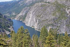
Donnell Reservoir
The Patterson Grade
Construction foreman John Danforth Patterson supervised the building of the steep grade from today's Donnell Vista down to the Clark Fork. Just a third of a mile east of the Vista a dirt road angles away from the highway. You can park there and walk down the old Patterson Grade that used to strike fear into many early motorists. Boulders and bushes have now made passage difficult in places.
Deadman Creek
One mile past Chipmunk Flat is perhaps the best place to view the old wagon road. A long turnout beside the highway marks the spot. The Forest Service used to maintain signs there about the Sonora and Mono Wagon Road. From the turnout you can see long stretches of the road on the hillside across the creek.
Near the Summit of Sonora Pass
Beyond the hairpin turn just above the last-mentioned turnout, remnants of the rock embankment of the old road appear in places on the left.
Sonora Pass
At the top of Sonora Pass is a marker attributing the discovery of the pass to Andrew Fletcher. Fletcher was the superintendent of the Columbia and Stanislaus River Water Company and the owner of a sawmill in Sugar Pine. According to the account, Fletcher and a companion, Joseph Spier, discovered the pass while on a fishing and hunting outing in 1862.