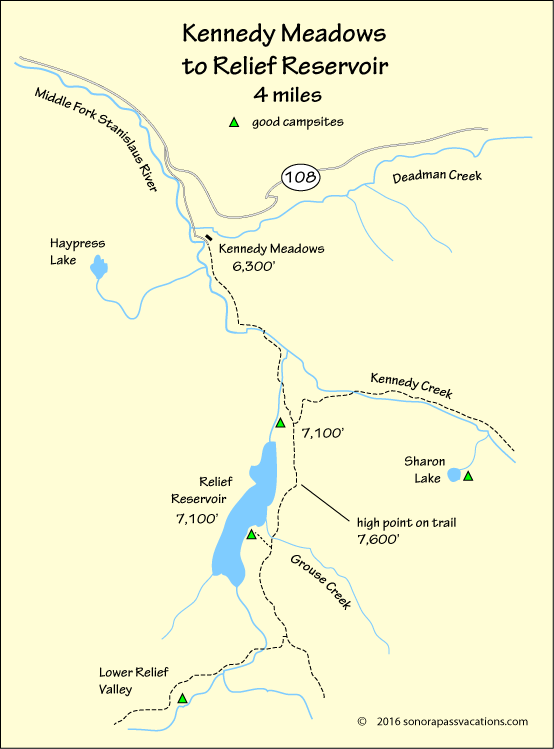
Relief Reservoir Backpacking Trail
Following the Old Dam Construction Road
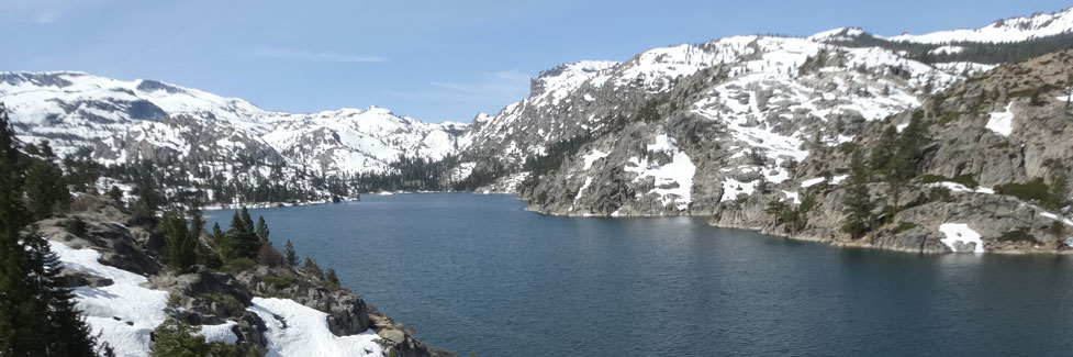
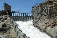
Only 4 miles from Kennedy Meadows rests 189-acre Relief Reservoir. The dam was constructed in the early 19th century when all of the equipment had to be hauled into the back country along a steep, rugged road. Steam powered winches were used to drag the heaviest equipment up the granite road.
The hike to Relief Reservoir can be made as a day trip, but it is more enjoyable as an overnight backpacking outing. Fishing is best at dusk or sun-up, especially near inlet creeks.
Shop Amazon:
Trout Fishing Best Sellers
Trout Fishing Best Sellers
The trail to Relief Reservoir climbs 1,300 feet from Kennedy Meadows to the route's highest point high above the reservoir before dropping to the Grouse Creek crossing and on down to excellent lakeshore campsites.
Getting Organized
Wilderness Permits for the hike to Emigrant Lake can be picked up at the Summit Ranger Station near Pinecrest. Park at the trailhead parking lot a quarter mile before you reach Kennedy Meadows. Pick up last-minute supplies at the Kennedy Meadows Resort store.
Starting the Hike to Relief Reservoir
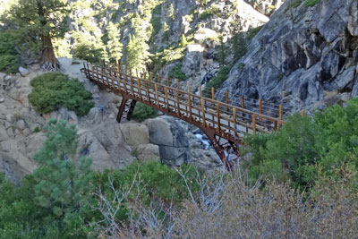
Follow the dirt road beyond the pack station over a slight rise and across Kennedy Meadow. The trail enters the Emigrant Wilderness at the far end of the meadow. Soon the trail crosses a bridge and begins a stiff climb up the old dam construction road carved out of the granite mountain side. A second bridge offers an overview of some good fishing spots along the river, dangerous in early summer when water is high.
The Heart of the Hike
Steep switchbacks lead up to the site of the PG&E maintenance cabin, which was dismantled in July 2011. A seasonal creek there may provide a good chance to replenish drinking water supplies. Continue past the cabin site, climbing toward the reservoir.
As you come even with the dam you catch your first glimpses of Relief Reservoir. The trail traverses up the slope high above the lake and then turns downhill to Grouse Creek. About a hundred feet beyond Grouse Creek (tricky crossing early in the summer when water is high), turn off the main trail onto a use-trail and head down to the lake.
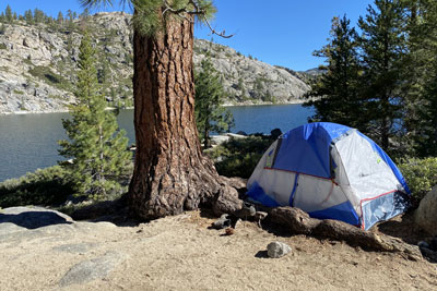
Camping at Relief
A point of land provides excellent campsites. Large groups have plenty of room in the main area of the point to spread out and set up multiple tents. If the point is occupied, follow the shoreline around to the left to more nice campsites.